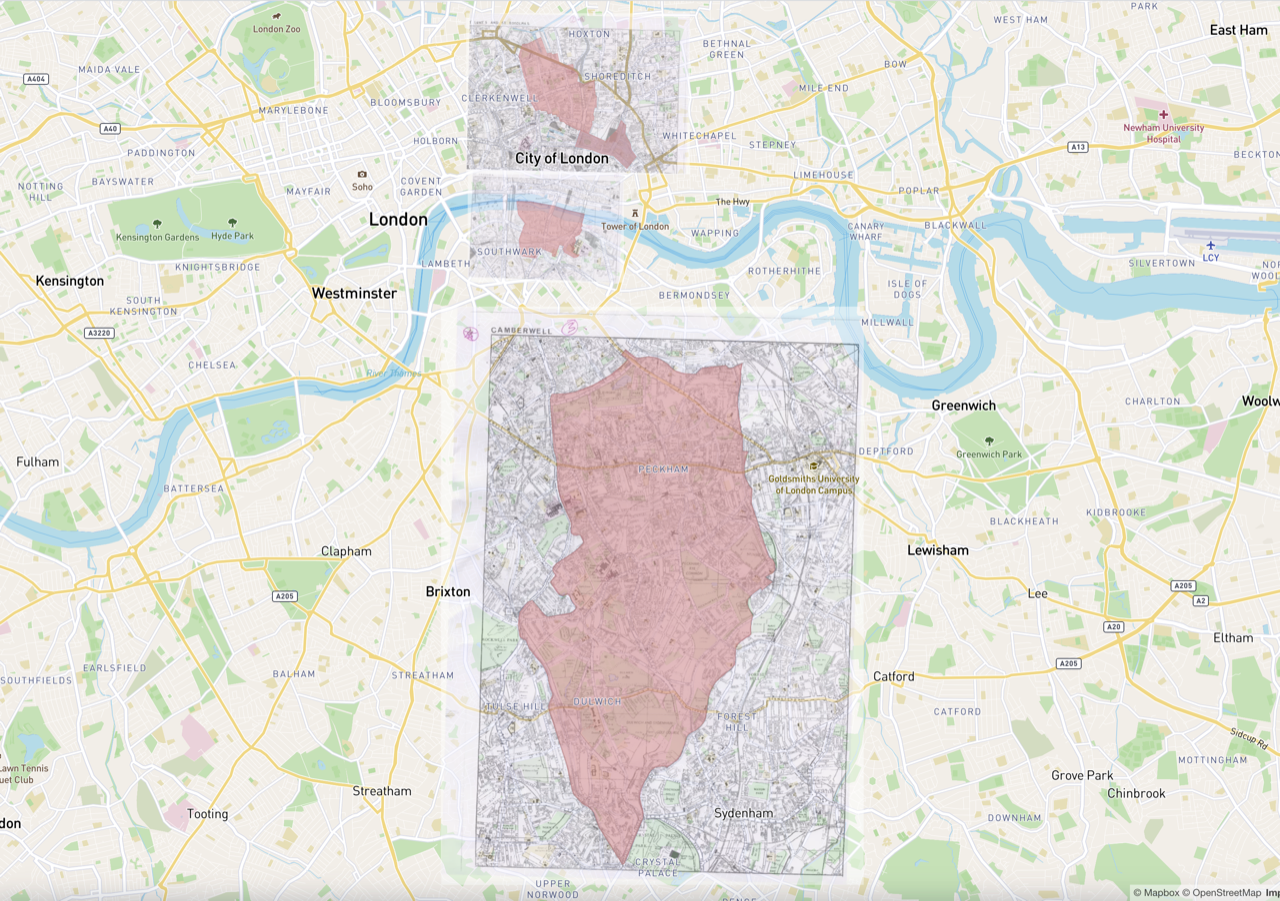
Drawing our areas of benefit
As those familiar with the history of the local area will likely already be aware, the Dulwich Almshouse Charity is over 400 years old and its areas of benefit – the specific parts of London where anybody must live to be eligible to live in the Almshouse – are drawn along the ancient parish boundaries that were set in 1891.
They are defined as the former parishes, as constituted on 1st May 1891, of St Botolph, Bishopsgate; St Luke, Old Street; St. Saviour, Southwark and Camberwell.
These historic boundaries have often been difficult to decipher and so to help our stakeholders and future residents identify these boundaries and assess eligibility for residency at the Almshouse, the charity commissioned the development of a searchable digital map. The map has been developed by Rosalyn Ellis of Maproom and allows users to enter a postcode and instantly find out whether they reside within one of the charity’s areas of benefit.
Drawing the areas of benefit was a complex task that involved extensive work to match these areas as closely as possible to historic boundaries from hundreds of years ago, relying on historical maps and other documentation and taking judgments on current buildings and developments that sit astride the boundary. The final product is a detailed, zoomable and searchable custom map, which we hope will be a useful tool both for potential residents and their families, along with those with responsibility, within the local authority, for ensuring older people are able to live in suitable and secure accommodation.
You can find the map here: Area of Benefit Map
Click on a picture to view gallery: